- Description
- Information
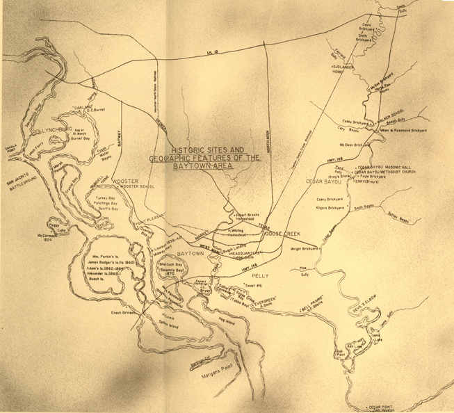
Hand-drawn map of the Baytown area
- Author
- History of Baytown, inside front cover ; Baytown Historical Museum
- Posted on
- Thursday 21 July 2016
- Dimensions
- 6984*6350
- Filesize
- 4097 KB
- Tags
- Baytown, maps, needs info
- Albums
- Visits
- 3688